Autumn Blues on the Northern Tier
i . November
November always gets me the worst. It's wandering season's last-gasp clearance sale, Everything Must Go, before winter consumes this latitude in her vindictive clutches. Once the calendar flips into December and beyond, even when local appearances might seem to favor a day-long joyride, there is often great deception. Entrapped by mountains on one side and the Snow Belt on another, a difference of so much as thirty minutes or thirty miles can incur dramatic changes in temperature and precipitation. But in November the weather is still cooperative regularly enough and the fear hangs over my head that any mild weekend surely will be the last good weekend until spring and thus it would be a criminal waste not to take advantage of that likelihood for explorative purposes.
It’s also this part of the year during which the passing of time is most flagrant. Throughout the natural world things are dying or going into hiding, an immutable reminder of the cold facts of this mortal coil. Only humanity is taxed with the capacity to consciously recognize and dwell on the finite span of its own being, and thus suffer the negative emotions, like regret, that tend to breed from such knowledge of the forbidden fruit. In the road I find solace from inescapable truths, a means of somehow pausing the unstoppable march.

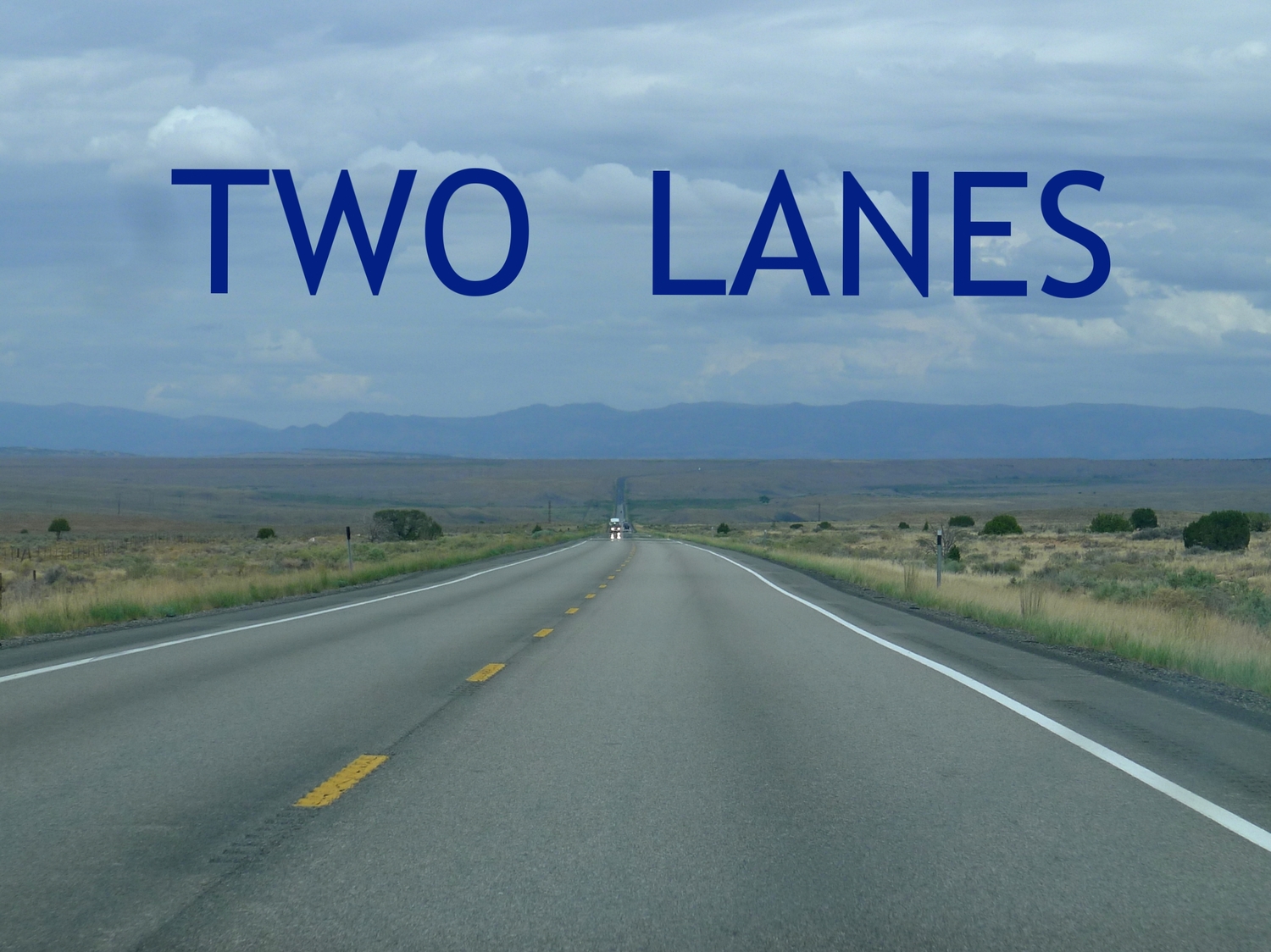
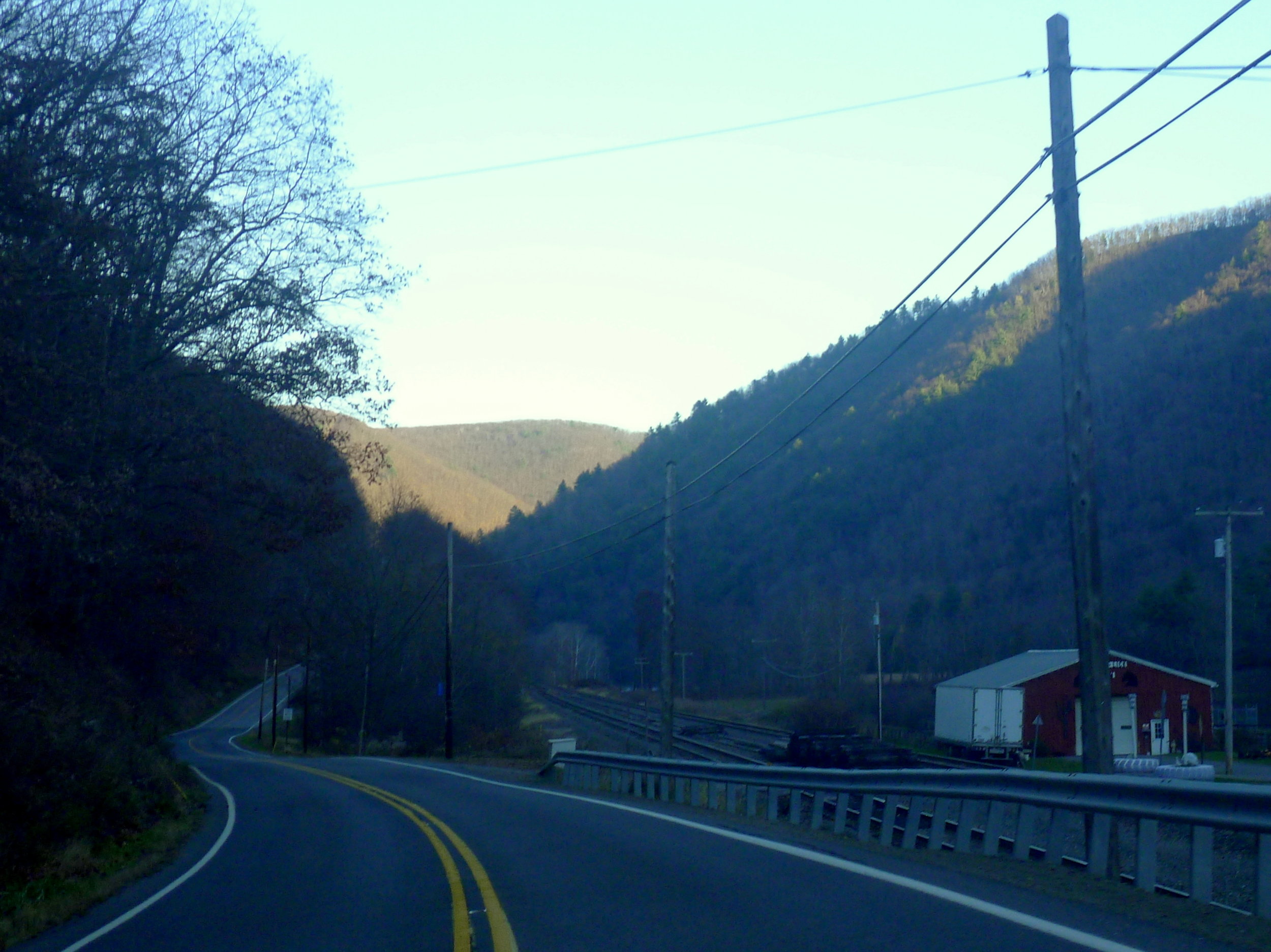
This is how I find myself on an arbitrary Sunday between Election Day and Thanksgiving, taking the 62nd Street Bridge across the Allegheny River, my companion preoccupied with a greasy gas station breakfast sandwich. We've decided to escape from the city on Pennsylvania Route 8, just to do something that isn't the old standby of PA 28 or, worse, the listless tedium of I-79's state trooper-infested waters.
Route 8 isn't so bad, it turns out, passing first through Etna, a compact and surprisingly intact old industrial borough wedged into a nook off the Allegheny Valley hewn by the prehistoric ancestor of the trickle that today is Pine Creek. Beyond Etna, development along Route 8 is hemmed in by the hollow of the creek. When suburban-style commercialism does try to break out, the results are restrained: a stunted strip mall here, an undersized big box store there. It's practically demure, a far cry from the Boschian hellscape that has spawned up and down the parallel McKnight Road corridor just a few kilometers to the west.
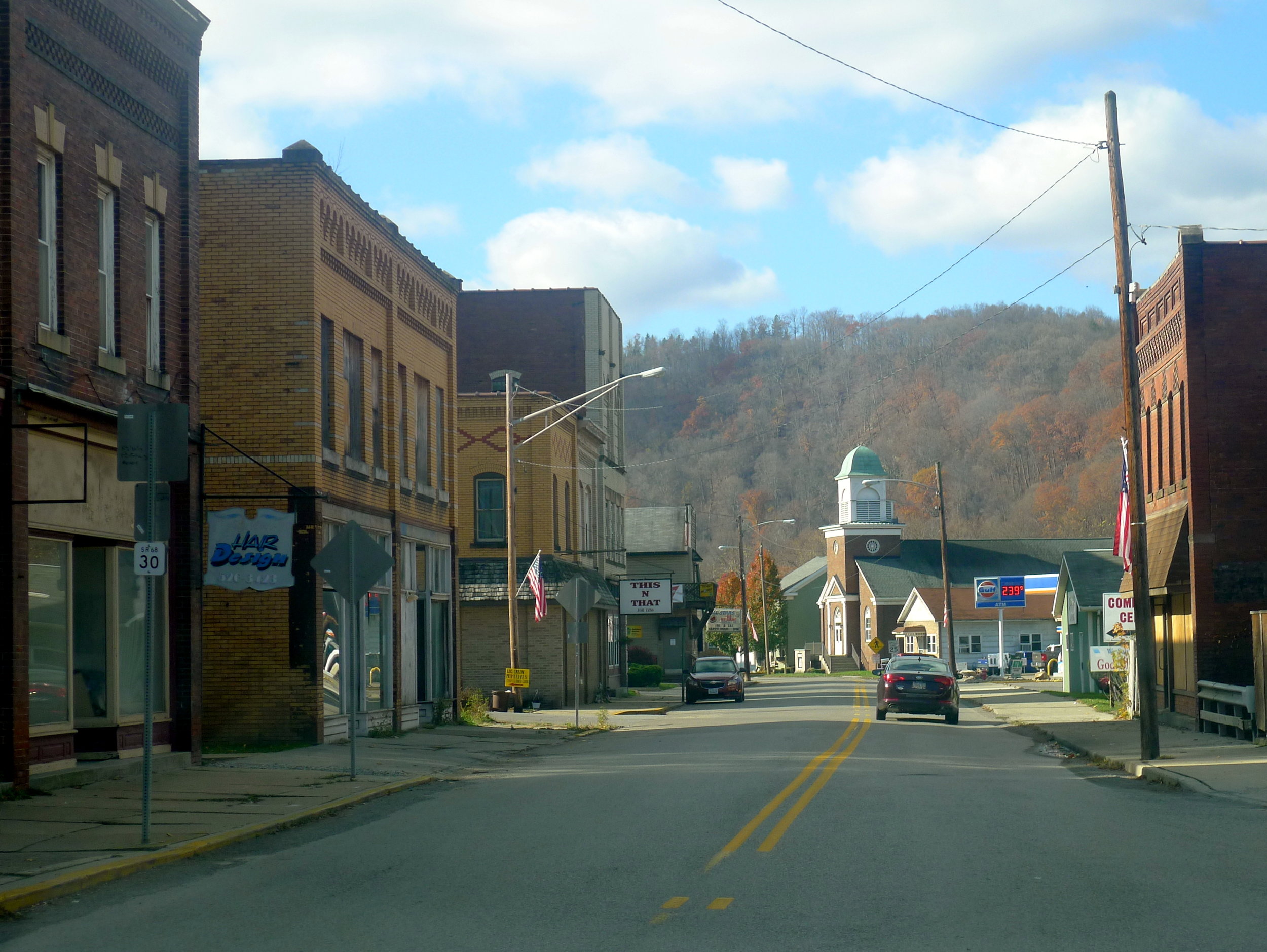
In Hampton Township the road diverges from the creek, which presents the opportunity for suburbia to more fruitfully take root. Soon the sprawl gives way to Butler County, a transition marked by the appearance of feed stores and advertisements for gun bashes. Suddenly the city of Butler is upon us, first evidenced by the steel mill on the opposing bank of Conoquenessing Creek. Butler is Rust Belt disguised as rural county town. Pullman-Standard used to make rail cars here; the Pullman-Standard plant is underneath a parking lot now.
The courthouse is impressive, Main Street fairly filled in and extensive, but I am not drawn in. It's a well-preserved example of Small Town USA, just not a markedly captivating one to me at this moment. Perhaps I'll be back to give it a closer look, but for now, I'm sufficed with simply making a wrong turn and having to navigate a warren of alleyways behind churches right as Sunday morning services are letting out. Eventually we find our way to Jefferson Street and jet into the countryside.
ii . Cereal
The oppressive granite tent of morning has given way and the day has evolved into one of those whose crisp beauty only deep fall can conjure. Plump, hale two-tone clouds litter the sky. Their tops are blindingly white, their bottoms a heavy charcoal, as if they had been left on the heavenly Brinkmann a bit too long by an absentminded Saint Peter, neglecting his duties as divine grillmaster to mingle with those recently admitted through the pearly gates. In sharp contrast, the space in between is unerringly blue and bright.
We meet up with the Allegheny again at an emphatically twisty section known as Brady's Bend, where the waterway nearly curves fully back on itself as it carves its course through the ancient plateau. A bridge carries us over to the hamlet of East Brady. In short order PA 68 ascends to the spiny ridge atop the strange world here, where the same river runs on both sides of us, to the left and to the right, an anomaly of geography. Clarion County dissolves beneath our tire tread. We spit on I-80 when it imposes its presence, trying to trick us into submitting to its poisonous charms as it cuts across our path.
In Fryburg, lorded over by the regal parish church up on a hill, we come upon an open-topped truck casually lumbering up the road in front of us, transporting some kind of grain. Wind shears fine layers of popcorn kernel-sized pellets from the bed, which skitter along the asphalt and bounce up into my windshield in a cacophony of unnervingly loud clicks and clacks.
It’s as though we are being belligerently bombarded by that most innocent and nostalgia-inducing of American culinary inventions, sugary cereal. My companion recites the catchphrase for one such brand in perfect deadpan—“Gotta have my Pops”—as the onslaught continues relentlessly. The absurdity of the scene becomes too much to stifle, and muffled chortles cascade into uncontrollable, hysterical fits of laughter in that unashamedly effervescent way afforded by the pseudo-privacy of a car. Squinting through the tears, I just about manage to keep from careening into adjacent farm fields.

iii . Numbers
Finally we ditch the cereal truck and Forest County announces itself with exactly that, stands of droopy-leafed, skeletal trees flanking the road, escorting us to another reunion with the Allegheny River at Tionesta. It’s one of the state’s puniest county towns, but an important jumping-off point for the Allegheny National Forest, “Land of Many Uses,” as the U.S. Forest Service likes to bill its wards. Here the river is fat and slow, easy to accompany northerly, contraflow.
This is U.S. Highway 62 now, one of my favorites for the haphazard manner in which it slices diagonally across the country from Niagara Falls to West Texas, aggressively bucking the typically orderly grid of the U.S. Highway system while passing near very little of consequence during its ten-state journey. In fact, between Columbus and Northwest Arkansas, the route does not traverse a single town of appreciably more than 30,000 residents, and it doesn't get a whole lot busier from there: further west from NWA (105th), only Oklahoma City (41st) and Lubbock (159th) stand amongst the nation's 200 most populous metropolitan areas until it reaches its terminus at the border with Mexico in El Paso (68th).
Despite this idiosyncratic aversion to urbanity for such an ostensibly significant route (clocking in as the 11th-longest U.S. Highway), it still seems to pop up everywhere I go. When my better half moved home to El Paso after we finished school in northeastern Ohio, I always extracted some degree of comfort from simply knowing that I could get on a road twenty minutes or so from where we had met and follow one solitary number all the way to her. On this November midday, however, we are heading in the opposite direction, away from Texas.
Not far along comes the intersection with the questionably-numbered PA Route 666. Many states have been careful about handing out this number given the regularity with which route markers go missing (highways assigned 69 and 420 are also reputed to have this problem, oddly enough), but evidently PennDOT is not overly concerned. Perhaps the opportunistic general store near this T-crossroads helps in that regard; after all, who needs to steal an unwieldy two-foot by two-foot metal sign when you can instead buy a beer stein bearing the slogan, "Route 666 It's a HELL of a ride!"
In a way, the devilish number does lend a certain mysteriousness to the road, which permeates deep into the occult heart of the National Forest. Maybe Hansel and Gretel are in there, trying to escape a gruesome fate in the oven of die hexe. There are modern frights, too: the last time I had ventured onto Route 666, I witnessed a convoy of trucks wielding what looked suspiciously like fracking fluid right through the woods, taking the Land of Many Uses to the logical, tragic conclusion the moniker euphemizes. This road is not in our purview today, though. Not even the crude handmade sign roughly hammered into the ground and pointing down Route 666 with promises of "Old Fashioned Ring Bologna" can tempt us, probably for the best. It could very well be the work of a present-day sorceress, hoping to lure the hungry, unwary traveler into her den. Instead we continue to hug the river until we reach U.S. 6, the primary thoroughfare across Pennsylvania's Northern Tier.
iv . Raincoat
Born of dirt logging roads, Route 6 was once a crucial east-west transversal of the state in the decades before Interstate 80. Nowadays it's much more sparsely trafficked, frequented chiefly by the big rigs involved in the commercial trades of the region and the occasional inquisitive, loose-footed soul.
In tandem, 6 and 62 convey us upstream to the town of Warren, Pennsylvania. Rounding a bend in the Allegheny, Warren bursts forth with a flash of color and the fleeting sight of a modest eight-story skyscraper poking up behind the copper-roofed clock steeple of a handsome, wedge-shaped flatiron building. I immediately take a shine to the town, far more so than I had to Butler. It feels like an opportune moment to stop for a stretch.

A small triangular plaza with a fountain whose base is bedecked with sculptures of stoic, proud-looking bucks anchors the main business district, which is encrusted with a rainbow array of mostly-occupied brick storefronts. Many are not accepting patronage at this time—Sunday is still revered in these parts—but a foray away from the river into the surrounding blocks reveals more clues into the heartbeat of this little burg.
Warren soared above its status as a run-of-the-mill timber outpost because of oil, unearthed in this region during the 1870s and kicking off a boom that saw the town prosper far beyond what its own imagination would have dreamed possible. This newfound wealth erected the varicolored Victorians and roomy Foursquares populating the tree-lined streets encircling the august county courthouse, unusually removed from downtown in a quiet residential neighborhood (to a rather pleasant effect, it should be noted).
Around the corner is another gift from the thriving late 19th-century economy, the Struthers Library Theater, an artifact that has been lovingly restored and currently hosts local stage performances, classic film screenings, and the like. It's not a mission that smacks of a town with two feet already in the coffin. Indeed, at least on the surface, Warren seems to possess more vim and vigor than many of its "bitter-clingin'" brethren throughout the Commonwealth, the decaying coal towns, rail towns, mill towns that are the resigned fodder for chin-stroking New York Times longreads, disaster porn photographers, and undistinguished amateur blog writers. It's still the black gold that's priming the pumps of Warren's aortic valve, the crude being pulled from the ground and refined right there in north-central Pennsylvania by the United Refining Company, better known by its nom de guerre, Kwik-Fill.
One additional piece of the puzzle is presented during the walk back towards the main street in the form of a large, low-lying brick building finished with Art Deco flourishes, inhabiting the vast majority of the square block on which it sits. A curious fixture on the corner of 3rd and Hickory explains everything. It's a four-sided analog clock, boxy and metallic, an early-20th century take on how everyday things might look in the nebulous future. In lieu of numbers, the characters N E W ` P R O C E S S ` are arranged around the face.
In 1910, a man named John Leo Blair took up an offer to sell raincoats on behalf of a classmate who had recently inherited a raincoat factory. He had the rather odd epiphany to invent a stylish black raincoat for undertakers and sell them across the land by mail. These slickers became such a smash hit with a much wider clientele, Blair was able to expand his company, which he named the New Process Rubber Company, into a full mail-order retail enterprise that grew into one of the most successful such operations in the country. Having weathered some bumps in the road owing to the rise of the Internet, the company—now called the Blair corporation after its founder—remains Warren County’s largest employer and is still headquartered in this complex.

v . Renege
Bidding an amiable adieu to Warren, we recommence our progress eastward. U.S. 6 meanders down into the federal forestland, but we opt to keep traipsing after the Allegheny. After a few miles a concrete slab appears, the Kinzua Dam. Past it, the river swells into a languid body of water: an artificial lake whose creation necessitated the drowning of 10,000 acres of land that had legally belonged to the Seneca people since 1794, according to a treaty signed by Chief Cornplanter and none other than George Washington himself.
In turns out, to no great shock, that the signature of the Father Of Our Country, as deified as he is, would come to mean very little to the subsequent generations of the colonizers’ government that he had done so much to nurture in its nascent stages. Initially contrived in the late 1930s as a flood control measure, part of the U.S. Army Corps of Engineers’ public works blitzkrieg under the New Deal, the construction of Kinzua Dam wasn’t actually ready to begin until 1960. By that point, Seneca Nation had organized an intelligent and fervent resistance to the project, but their cries fell on deaf Congressional and even Presidential ears. The saga would be immortally lamented by Johnny Cash in the ballad “As Long as the Grass Shall Grow.”
The confluence of the Allegheny River and Kinzua Creek would be indistinguishable in the obesity of the waters but for the unsightly bridge across the mouth of the creek that transports oblivious motorists, eager only to reach their destination, neither knowing nor caring that they're rumbling over what was once the focus of an entire culture, now submerged, sacrosanct burial grounds desecrated by the induced inundation.
Cornplanter, can you swim?

vi . Playground
We rendezvous again with U.S. 6 in time to pursue it through Mount Jewett, a speck of a village that rests between the headwaters of three different stream systems: the Kinzua, the Clarion, and the Potato. Each arises in almost perfect cardinal opposition to the others, yet all three eventually pour into the Allegheny, further evidence of the eccentric properties claimed by the earth here.
A piecemeal Main Street wastes no effort in informing passersby of the area’s Swedish heritage; the yellow Nordic Cross on cyan background features prominently at every opportunity. These displays are made to seem downright monochrome by an incongruously Technicolor mural plastered to the next cluster of dilapidated buildings. This is my cue to keep my eyes peeled for Bridge Street, the back road that will wind us to the day’s primary goal.
Kinzua Creek, while today not much more than an inoffensive gurgle, managed to dig an appreciable gorge over the course of its geologic history. This gorge was deep enough that the construction of a railroad bridge spanning it in 1882 would be the highest such bridge in the world at the time and, as such, was hailed as a unique feat of engineering. The designer of the viaduct, the superbly named Frenchman Octave Chanute, would turn his passion and intellect to aviation in his advanced years, going on to act as a mentor of sorts to a pair of erstwhile bicycle mechanics from Ohio, brothers called Wilbur and Orville.
Meanwhile, after an all-steel reboot at the turn of the century, Kinzua Bridge remained in the service of the railroad through the 1950s, until consolidation of the big rail companies rendered the route incorporating the bridge redundant. It was sold to the government of Pennsylvania in 1963 and preserved as the centerpiece of a State Park that would later run excursion trains across the trestle. It was an amply popular attraction that the PA Department of Conservation and Natural Resources chose to put money aside to strengthen the bridge. Work on these upgrades began in 2002, requiring a temporary closure—or so it was assumed.
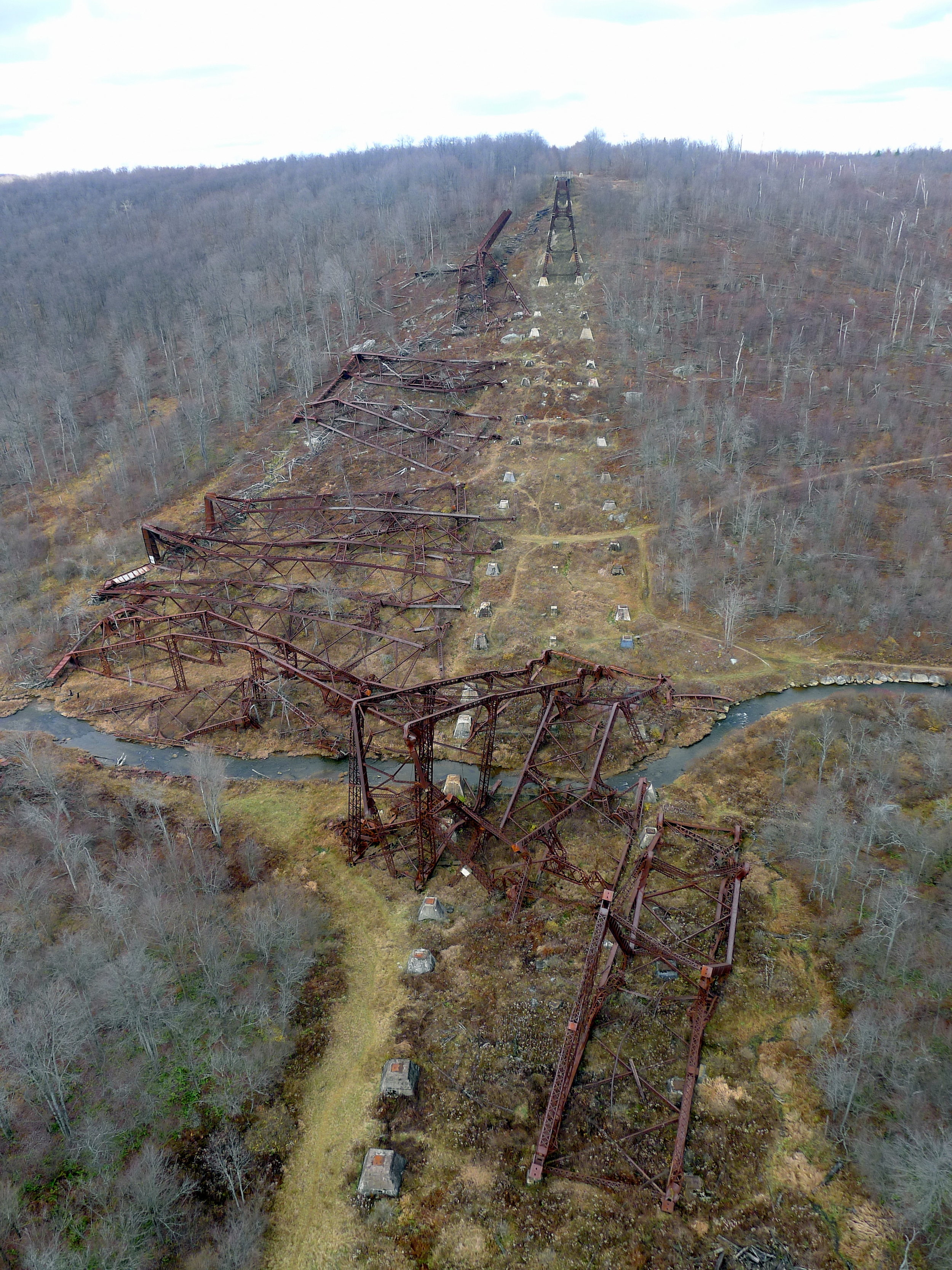
One muggy July afternoon in 2003, a freak storm system roared through northern Pennsylvania, bringing with it conditions ripe for the formation of tornadoes, one of which touched down in the valley of Kinzua Creek. Though a mere F1, it was able to wholly ravage the bridge, ripping half of its mighty stanchions from their concrete moorings and tossing them to the floor of the glen.
It would have cost tens of millions of dollars to rebuild the bridge, money the state didn’t have. So, much to their credit, instead of throwing their hands up in self-pity, the folks at the PADCNR decided to squeeze fresh lemonade out of the calamity and made the ruins themselves the new selling point of the park. It was an intriguing premise, and Kinzua Bridge was one of those things that had long been on my radar that I had just never gotten around to checking out until this autumn expedition.
When we drop in a fancy new parking lot and visitor center facility are in the works, but their current form is that of a pile of rubble decked in yellow ribbons of CAUTION tape fluttering in the steady breeze. For now visitors are directed to park in a muddy patch of gravel that requires a brief hike to the bridge itself. The endeavor is rewarded far past even my optimistic preconceptions.
The standing half of the bridge, anchored to the south slope of the valley from whence we’ve arrived, has been reinforced and converted into a wooden skywalk. permitting those free from the grip of acrophobia to venture out until they’re suspended nearly three hundred feet above the ground. The extra-brave can walk along the tracks themselves, nervously hopscotching the disquietingly wide gaps between ties.
Reaching the end of the walkway yields the first full glimpse of the wreckage strewn about the valley floor, an awesome bird’s-eye view of the fury of nature’s reckoning. Looking at the crumpled and twisted steel bones, slapped aside so effortlessly, I try to picture what it must have been like to actually witness such destruction taking place. The only frames of reference I have are the controlled demolitions of sports stadiums, or grainy memories of watching in horror on television as the World Trade Center collapsed. It’s even more chilling when you eliminate human agency, though, leaving you at the mercy of a violently untamable, unsympathetic act of god.
Already the Kinzua Bridge has lived up to the hype I’d prematurely bestowed upon it, well worth the detour, but it turns out the fun is just beginning, for the blustery amble back to solid ground reveals what looks like a primitive trail snaking down into the hollow. Curiosity piqued, an investigation is in order.
A manicured path leads to another wooden observation deck, complete with quarter-operated binocular device, granting an impressive side-angled view of the bridge, both the intact and the devastated portions in concert. Branching off to the left is the trace of dirt that descends into the valley. A coil of switchbacks through the thick but denuded woods suddenly deposits us breathtakingly within feet of the colossal structure. The trail now is nothing more than a track of tamped-down grass, with only a small sign acknowledging that people are intended to tread any further.

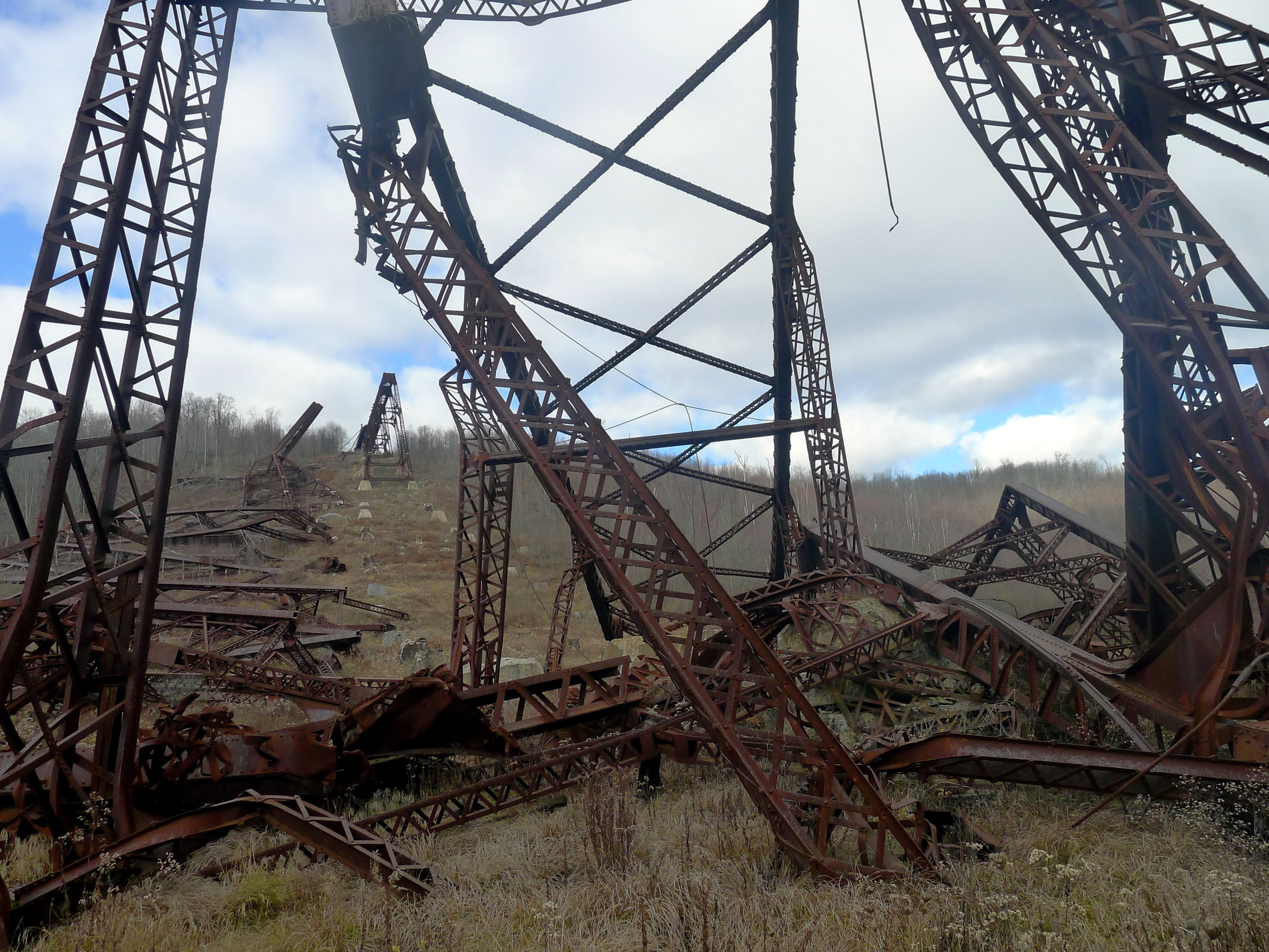
We pitch forward down the hill in the shadow of the rusting hulk, close enough to climb onto the concrete blocks holding the legs in place if we so desired. At one point the marked trail veers off to the right, back into the forest to continue its slalom down to the creek, but there is no explicit warning not to keep picking through the ruins if you'd prefer. In fact, I am struck by the lack of formal regulations posted anywhere here. Nothing is fenced off or otherwise physically prohibited from access. Emboldened by this, I forge on, slinking between the last pair of erect trusses and a graffitied beam nearly as tall as I am even in its horizontal slumber.
I emerge on the other side of the bridge, still expecting to be ambushed by the PADCNR Stasi at any second. But all is quiet as I trek deeper into the valley, the no-longer-burdened blocks resembling little ancient temples as I pass. And then I am face to face with the heaps of gnarled steel, somehow more inconceivably monstrous than they had seemed from above, the red tint of oxidation flaring into a rich copper hue whenever the sun peeks out from behind the quilt of clouds.
My progress through this magnificently terrible wonderland is halted only by the barrier posed by Kinzua Creek. It looks easily fordable, but not in November, without backup footwear. I’m satisfied just to hang out amidst the rotting latticework and marvel at the fact that I am allowed to be doing so at all.
I recall all of the wacky playground apparatus I loved as a kid—those rope spider web-like contraptions, intricate wooden pirate ships, etc.—that have since been dismantled on account of being “too dangerous” in the wake of the national pastime known as litigiousness and uniformly replaced with pre-fabricated, unimaginative jungle gyms over a spongy rubber surface. Kinzua Bridge is, at long last, my childhood’s revenge.
I could spend hours meditating in the shade of these warped, otherworldly arbors, but the shortening afternoon wants those hours, too, and that’s a tug-of-war battle I’ll never win.
vii . Mogul
Grudgingly we return to the blacktop, eastbound on Route 6 once again, through a sequence of towns that contain “Port” in their names—Smethport, Port Allegany, Coudersport—in open defiance of their landlocked status (though the Allegheny graces the latter two, having reemerged from a brief sojourn into New York). All three are adorned with elegant Victorian homes in varying conditions of upkeep or disrepair, but their commodious sizes harken back to the well-heeled days when lumber was king and this part of the globe possessed a virtually inexhaustible supply of it.
In Coudersport, however, it’s not the ornate painted ladies that represent the most visually striking architectural feature. That honor belongs to the veritable palace looming ludicrously over Main Street, a neo-Georgian behemoth in gauche red brick against building-high reflective windows and two fat, purple marble columns astride the front entrance. Such a beguiling exhibit of tacky opulence is jarringly out of place in this humble logging camp, but the ultimately Icarusian story behind it is, in my book, one of the most apt apologues of the advanced-stage capitalism unleashed on the world by the monolithic United States of the late twentieth century.
John Rigas arrived in Coudersport in the early 1950s as postwar American exceptionalism was getting into full swing, fresh off combat duty in France and dreaming of something more than his family's hot dog shop in Wellsville, New York, just on the other side of the state line, or his shift at the Sylvania electronics plant down the road in Emporium, Pennsylvania.
Rigas' first venture, a one-screen movie house, was not as profitable an endeavor as he had hoped, so, as the story goes, he overdrew his bank account to buy the local cable service for $300. It was this antenna on a nearby hillock that would sprout over the ensuing decades into the giant called Adelphia that at its zenith was the sixth-largest cable provider in the country. Rigas found monumental success filling in the gaps between major media markets and was later joined in the business by his three sons as the empire's coverage expanded to thirty states.
While Adelphia exploded into a household name, Rigas opted to maintain the company’s base of operations right there in tiny Coudersport, much to the befuddlement of the power brokers and money men in New York City and Philadelphia. Potter County had been mostly a spectator of every economic boom that the Keystone State enjoyed, but Rigas was now putting it on the map in unmissable bold type and size 24 font. His beneficence in the community was the stuff of legend: a job found for anyone who asked, favors dished out unremuneratively.

Photo: Nyttend, via Wikimedia Commons
Rigas had a critical weakness, though, and that was his brazenly cavalier attitude towards money. Aggressive spending and borrowing had enabled him to grow his dominion so robustly, but as the century came to a close, it emerged that Rigas and his sons had essentially been using the company as their own piggy bank, unbeknownst to most of the board members and other stakeholders. Countless personal expenditures, even those as whopping as the purchase of a National Hockey League franchise (the Buffalo Sabres), were financed with Adelphia money.
Not only was this highly illegal, but the book-cooking required to keep partners and shareholders none the wiser meant that the company was racking up obscene stacks of debt without anyone cognizant enough to sound an alarm. Adelphia declared bankruptcy in 2002, and after protracted litigation, in 2005 a fifteen-year prison sentence was handed down to an octogenarian John Rigas. (He only wound up serving 9 of those years, as he developed bladder cancer and, facing a prognosis of months to live, was granted compassionate release in 2015. As of early 2018 he is still alive, aged 93.)
That empty, palatial chateau out on Main Street in Coudersport? That was to be Adelphia's new corporate headquarters; its completion just beat the Chapter XI buzzer. Potter County receded once again into the state of perpetual stagnation that it had known for most of its existence, a much crueler fate now that the sweet nectar of prosperity had passed its lips. Meanwhile, the little cinema, John Rigas' original entrepreneurial enterprise, still boasts a lit marquee, touting a second-run blockbuster.
viii . Nowhere
With the angle of the sun’s rays diminishing, it’s time to formulate an exit strategy from these northlands. The most readily available course south mandates traversing a province geologists refer to simply as the “Deep Valleys” for the sharp lacerations myriad streams have gashed into the plateau atop the Allegheny Front over dozens of millennia. In some places the floor of a hollow lies a full thousand feet below the ridges of the surrounding bluffs, adding to the feeling of entrapment already lent by the region’s foreboding name. The terrain casts an inescapable prison of shadows, but the amber hilltops in the distance dangle a teasing promise.
This is the remotest area in the entire Commonwealth. The most significant thoroughfare spanning it, Pennsylvania Route 120, stakes a legitimate claim to being Pennsylvania's "loneliest road," but surprisingly, it wasn't always quite so forlorn.
The history of navigation through the Deep Valleys traces a fairly logical progression. Indian trails followed the natural paths provided by the West Branch of the Susquehanna River and the Sinnemahoning family of creeks as a means of portaging between the Susquehanna and Allegheny watersheds. Then, when the white man became consumed by his iron horse craze, the most direct overland link between Pennsylvania’s two biggest water ports ran through these gorges. And so here was laid down the trunk line of the Philadelphia & Erie Railroad in the period around the American Civil War.
The rise of the automobile created new demand for paved roads, and when the U.S. Highway System was being drawn up, it was thought that a route alongside the P&E (which had long since been gobbled up by the Pennsylvania Railroad) would have similar value as a vital connection between two consequential cities. Thus this route was handed its own federal designation: U.S. 120.
As road engineering improved practically by the week, it quickly became apparent that it was not ideal to bestow any modicum of import to any road through such difficult backwoods territory. U.S. 120 found itself superseded by corridors that skirted the Deep Valleys, subsequently truncated multiple times, and eventually decommissioned and handed over to state care, which is where things stand now: a mostly forgotten highway to nowhere, still braided around the old P&E tracks and the antediluvian waterways.
Nowhere, in this particular case, was once somewhere, and that somewhere was Renovo, what passed for the Deep Valleys’ major metropolis. Renovo exists solely because its spot was approximately the halfway point between Philadelphia and Erie when the P&E was built through. The company put a railyard and maintenance shops there, propping up enough of an economy to healthily sustain a permanent population in the several thousands.
For a century “the shops” were plenty sufficient to foster archetypical small town America, schools and churches and stores and taverns, up until the PRR ceased operations there in the late ‘60s. Renovo was thus forsaken to face the obscure, reclusive station its geographic situation surely would have dictated all along had it not been for the interloping presence of the railroad. Now the town is so isolated and irrelevant that the thousand and change hardy souls that continue to call it home did not have cellular phone service of any kind until 2011. One business sticks out as we fly past: a restaurant named “Yesterday’s.”

ix . Levee
Golden hour chases us from this peculiar domain’s crevices and crannies, the Susquehanna riding shotgun all the while. Something about this ancient river never fails to enrapture me. Maybe it's just the fact that it, amazingly, predates these mountains, which heaved upwards around its uncompromising flow hundreds of millions of years ago. It's earned my veneration as a sporadic, but loyal sidekick on my meanders through the Mid-Atlantic; I'm always thrilled to see it.
We are deposited in Lock Haven, one of those otherwise nondescript burgs that’s kept buoyant by the residence of a four-year university. It’s a phenomenon I’ve come to greatly appreciate and look out for in my travels, for such institutions lend a certain youthful energy to their environs. The school doesn't have to be especially big or prestigious for that vitality to be readily palpable and infectious to the random wanderer.
There is a bated stillness to the light’s last hurrah, as if Earth has lost a fragile belonging in a crowded room and shouted for nobody to move. The season extracts a melancholy chill from the air as soon as the sun disappears. It is one of my favorite time of day and time of year combinations—paradoxically, it must be said, for someone who is writing about a hobby that is defeated by both night and winter. But to me it signifies a sort of weary optimism, a primal demand to plow ahead through life's hurdles and pitfalls just as the spring will assuredly break through again. To soak it up I clamber to the top of the levee overlooking the old river. I allow myself a few minutes of contemplative solitude, alone with the twin chess-bishop steeples of the Clinton County Courthouse and the tranquil water below, and then we must proceed onwards.

x . Dark
The drawing of the curtains on the day instills a different type of mentality into a drive. No longer is leisure in control of the wheel. We can sneak into Nittany Valley through a crack in the invisible Bald Eagle Mountain and acquiesce to the convenience of the Interstate without any illumination to betray our sin. I-80 powers up the Allegheny Front, eschewing the serpentine curves of the older roads that had to surrender to the topography of the escarpment.
Empty stomachs plead for mollification, so a stop is made in Clearfield to eat at a wonderful pub that has the misfortune of sharing its name with a certain ubiquitous mediocre diner chain. “Denny’s Beer Barrel” is a very much independent entity that is infamous for its challenges involving multi-pound cheeseburgers, the Everest among them a 96-ounce gargantua that must be polished off completely within a three hour time limit. With considerable distance yet to plod in the dark, we settle for one of the creative half-pound offerings from the standard menu. Even that sits heavy as we waddle back out into the night, now verging on frosty. Pennsylvania’s sole ethanol plant silently chugs away over the tavern’s shoulder, its smoky exhalations camouflaged against the inky sky.
Sated nearly to the point of discomfort, we aim for a rough hypotenuse across the wrinkled landscape, penance for our earlier abandonment of the Blue Highways, brief though it may have been. We're almost precisely echoing the Great Shamokin Path to Kittanning; the Lenape had a pretty good idea of what they were doing, so naturally our roads are merely imitations of theirs.
The Amish arrived and were permitted to stay, unlike the indigenous peoples whom they usurped as the wardens of these fertile dales. Thus our journey is stuttered by the occasional apparition from the gathering gloom of incandescent orange reflectors hovering in midair. In reality they are affixed to the rear of a dawdling carriage, unapologetic for the sluggishness with which it moseys along. A silver lining is that the buggies outnumber other motor vehicles, which makes it easier to maneuver around them, straining my ears to catch the metronomic clip-clop of horse hooves at each pass.
Punxsutawney (“Town of the Mosquitos” in Unami, a Lenape tongue) lies dormant, the only sign of life evident in the faded red, white, and blue emanating from neon displays promoting name brand domestic beers, tacked to a pair of saloons engaged in a sad standoff of sorts down a dingy side street. The drab setting can be forgiven of a place whose biggest (and only, if we’re being honest) renown not only revolves around a rodent, but is most widely disseminated via a movie that was filmed eight hundred miles away in Illinois; Punxsy wasn’t regarded as pretty or charming enough to star in its own biopic.

Human-sized groundhog totems lurch out of the darkness to leer at us as we zoom by. Phil’s wood-carved brethren taunt us with the vow of a cold, nasty winter, as if the whole season is borne by a universal punishment for their hamlet’s languishing. Sure enough, we're no more than a few minutes beyond Punxsy when the heavy air finally caves in and the snow begins to tumble copiously from the heavens.
Kittanning beckons to us with a return to a fortified major expressway, an ostensibly merciful gesture that is actually more of a mixed blessing, if even that. An eighteen-wheeler sashays wildly to and fro across the lanes ahead of us, nothing more than a blur in the swirling blizzard.
We creep forward trepidatiously, distances unintelligible in the maelstrom but for the counting of bridges. One, then another, then another. One of them is the one we need, but in my mind, addled by these mounting hours behind the wheel, it will be the Kinzua Bridge, shredded and torn asunder. This fear is, of course, proven silly, and we safely leap the Allegheny one more time to slide down the hastily salted city streets that will lead us home.