Two Lanes

Take a different way home

  • Archive
  • "Transit" Maps
  • Contact

The Drive Home, Part III: The Salve

September 29, 2016 by W. P. Hill

I pass through the Narrows north of Cumberland, their sheer rocky faces obscuring what remains of the daylight. By the time I am free of their imposing clutches, dusk is well on its way to settling over the landscape. My angst from earlier begins to evaporate along with the day’s heat into the pre-twilight air as I think about the next segment of my drive.

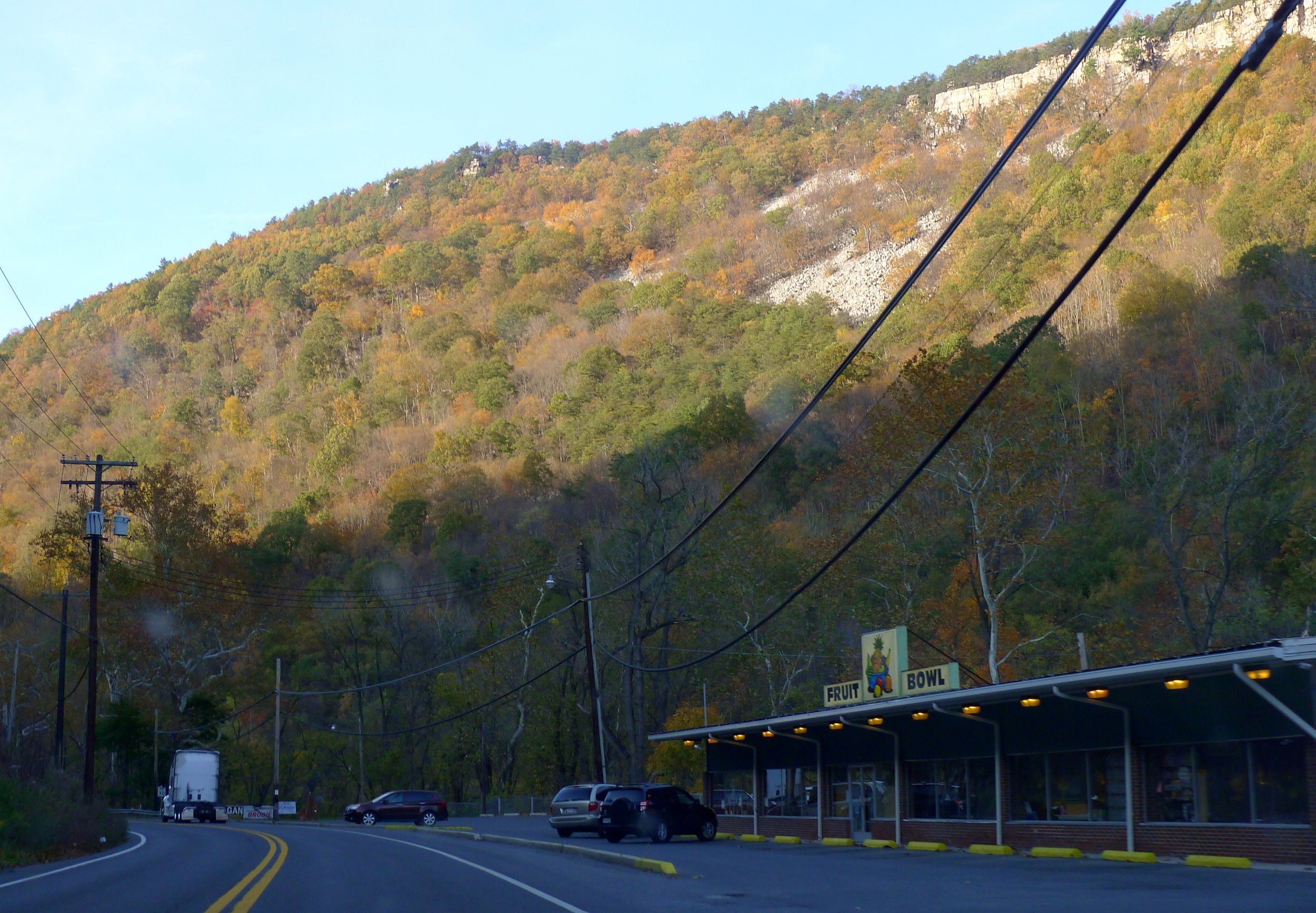
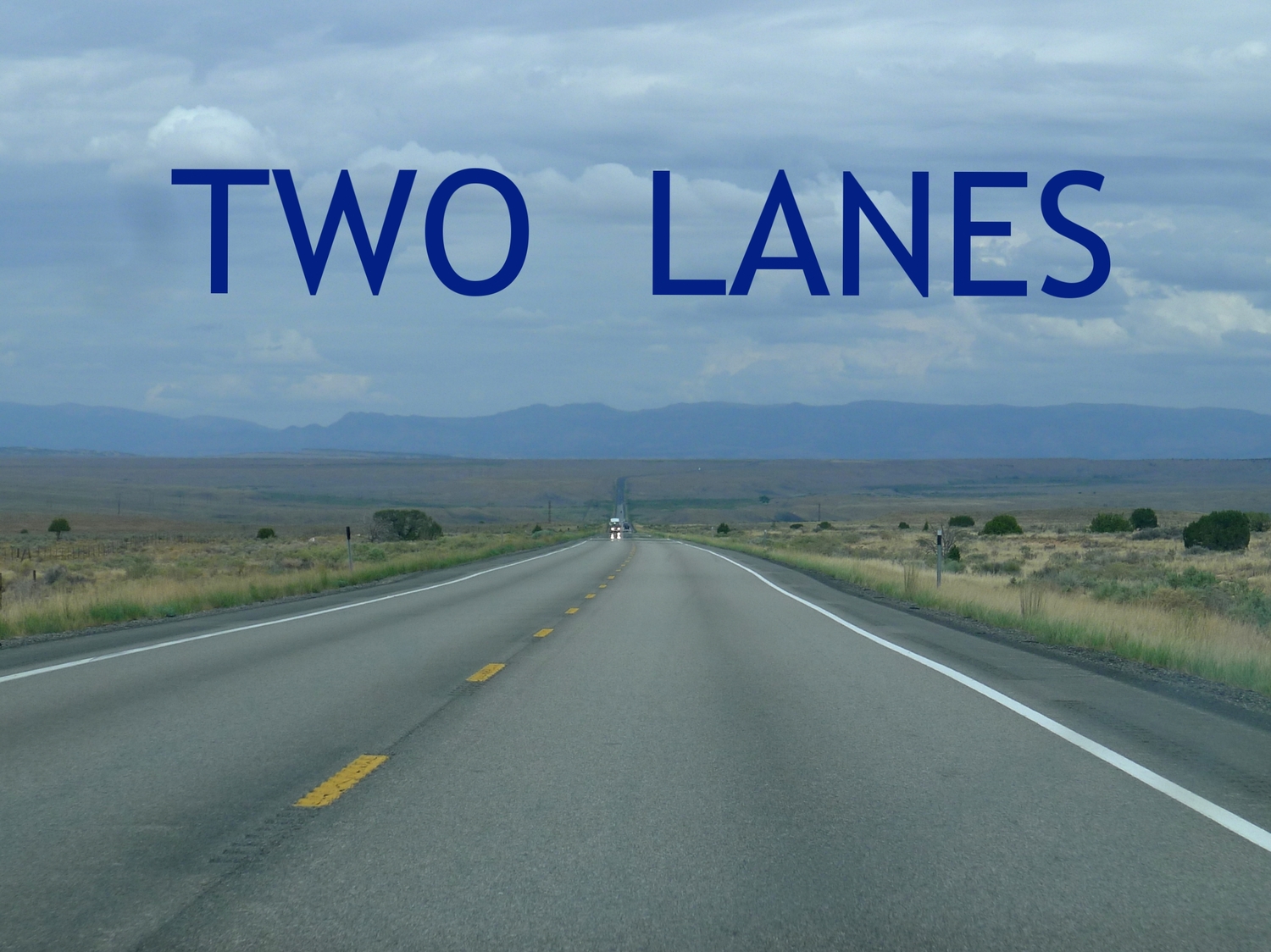
There's something indescribably special about the first time serendipity takes the wheel and reveals something that sears itself unforgettably into your mind’s eye. For me, one such watershed was the fortuitous discovery of Pennsylvania Route 160 as a hypotenutical shortcut (geographically, if not in terms of time) between southwestern Pennsylvania and Cumberland. From the Mason-Dixon Line northwest to the hamlet of Berlin, it comprises 18 glorious miles of good, old-fashioned, two-lane blacktop. Along the way it twists and turns, rolls and rises, dips and dives in concert with the undulant terrain instead of destructively punching through it.

Since that fateful April morning many years ago, I've ridden this textbook Blue Highway too many times to count. I've passed through in every season: through the stark, bare winter, above the damp, blooming spring, amidst the sticky haze of summer's peak, and under the cover of dazzling autumn color. I've done it sliding through torrential downpours, immersed in fluffy falling snowflakes, battling fog as thick as blood, and I've done it on some of the most spectacularly beautiful days you could imagine. It never gets old, still as fresh and intoxicating as it was when I first laid rubber to it.

If I’m lucky—if the weather is cooperative and there’s no one in front of me—I can treat this stretch of road like my own personal autobahn. I can take the curves at speeds that turn the yellow advisory chevrons a shade of blushing crimson. I know which upslopes to gun hard in order to experience that exhilarating plunge in my stomach upon descending the other side, as if on a roller coaster. If I do happen to come up on the tail of a slowpoke, well, that’s alright, too. Leisure is the muse behind taking a road like this, after all, not getting somewhere as quickly as possible. There’s the Turnpike for that.

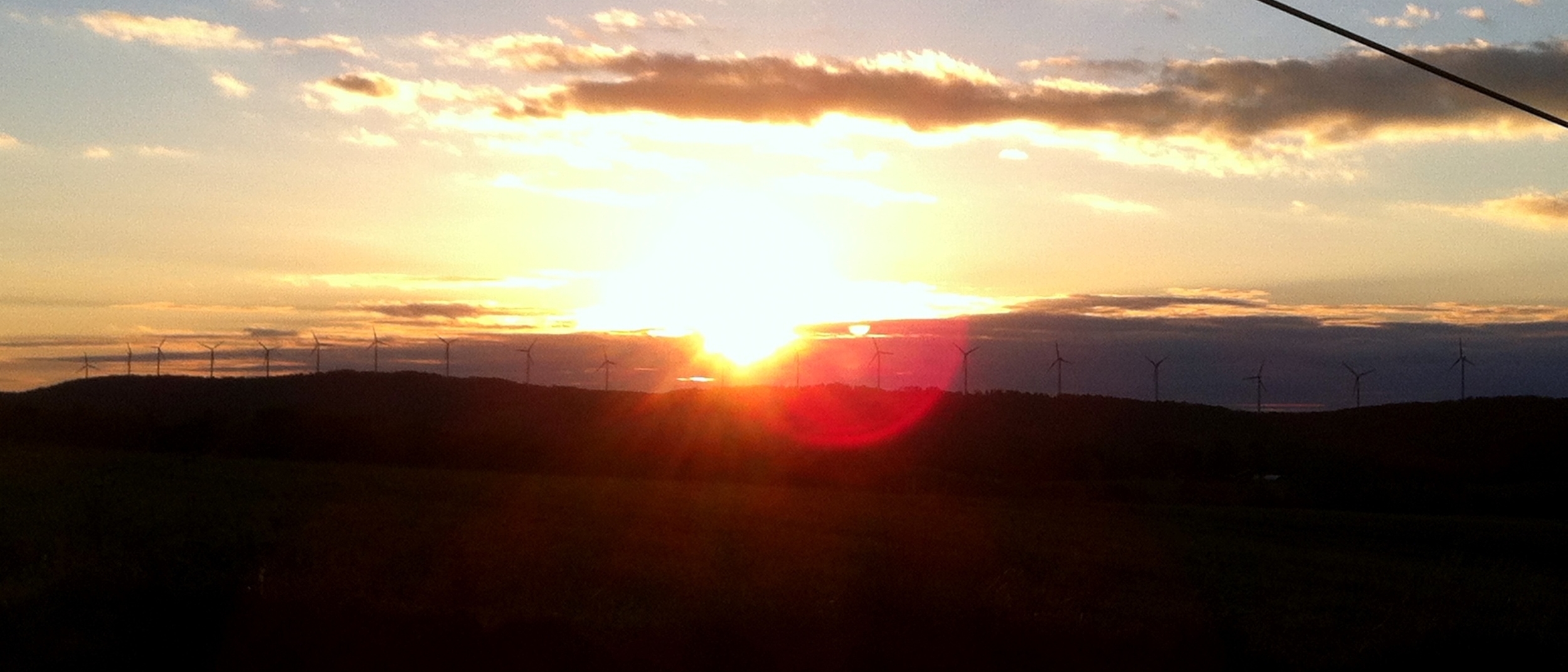
But what makes this route truly special, to me, is the nearly ubiquitous presence of what I opine to be one of the most graceful sights that can be found in nature. They are, ironically, man-made features, the first of which comes into view perched atop a ridge shortly after crossing into Pennsylvania. They are windmills, sleek and sterile white, their three slim propeller blades churning through the calm sky. Up close, the true force of the circular motion can be discerned, a steady whomp, whomp, whomp exhaled as the air is displaced. From the distance of the road, however, it looks merely a lazy pantomime.

No fewer than three different wind farms flank this portion of PA 160 as it snakes through the region. At times, vehicles pass close enough to a turbine that the driver is able to appreciate the enormous scale of the contraption. At other spots, the road offers panoramic vistas of entire colonies, strung out in an orderly fashion like army sentinels guarding a distant hilltop, making it easy to see how Cervantes would have been inspired four centuries ago. For the duration of this jaunt the windmills are almost never out of sight, elegant travel companions along this country road.

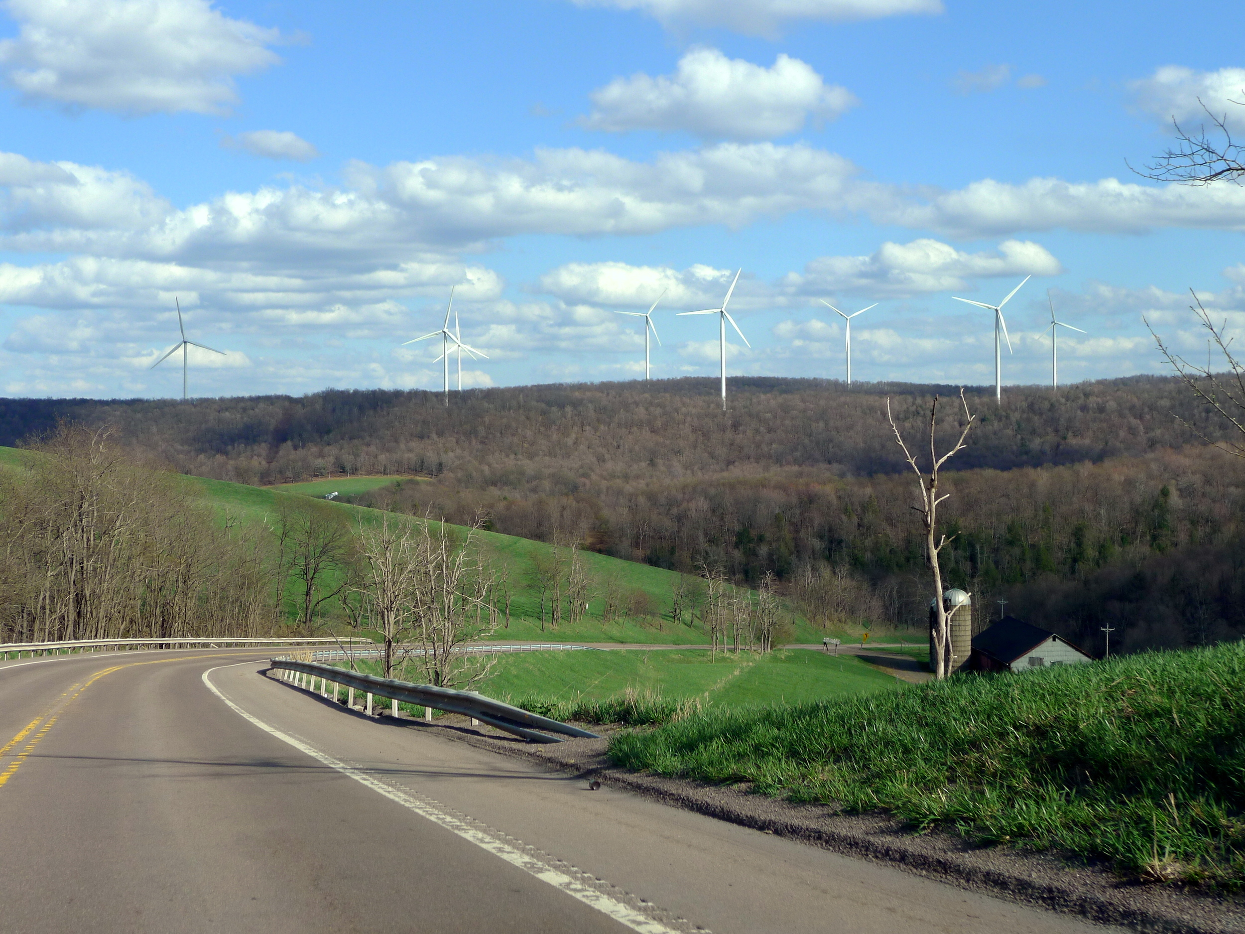
Eventually I power up the Allegheny Front and the windmills, now literally Quixotic silhouettes in the gloaming, grow smaller in my rearview mirror. Soon they are nothing more than their red aircraft-warning signals, pulsating on and off as though they are windtalking to an extraterrestrial race.

The road drops and rounds yet another bend, much as it has been doing for the majority of the ride since the state line. At the crest of this latest glen, however, I can catch a glimpse of the town on the hill, sheathed in faded gold from the disappearing day and capped by the cupola atop the quaint schoolhouse.

The town is visible for about ten seconds, just long enough to feel tangible, and then it is gone—at least, from my own eye. Life still goes on inside the town, of course. Years, decades, even centuries pass and, assuredly, some things change. For instance, a dozen-mile chunk of controlled-access highway has been constructed between the larger towns of Somerset and Meyersdale, ostensibly to create a more efficient link between the Turnpike and western Maryland. Upon completion, it co-opted the U.S. Route 219 designation that had constituted the main drag directly through the little town on the hill. Thus the hamlet was officially bypassed, cloaked behind a magician’s veil, effectively vanished to anyone traversing the area.

This is a far too familiar fate for small town America, but I still find it no less distressing when yet another community is rendered some degree of obsolescence by the allure of a fast, seamless four-lane vacuum. That is why I take comfort, albeit shallow, in the notion that the town will always look more or less the same from a distance, like a dollop of white paint dripped carelessly across this Appalachian hillside by the cosmos while she was going about dabbing the stars into their patterns in the sky. Perhaps it might not have appeared all that dissimilarly to Governor Thomas Mifflin when he rode in with federal militia troops in the autumn of 1794 to quell the Whiskey Rebellion.

Bittersweet is the knowledge that when I first see the town from afar, frozen in time, I am only a bit more than an hour from home. (For the sake of comparison, the analogous spot on the Pennsylvania Turnpike is hurtling past the sign informing me that I can treat myself to a lamentable burger at the Somerset Travel Plaza).

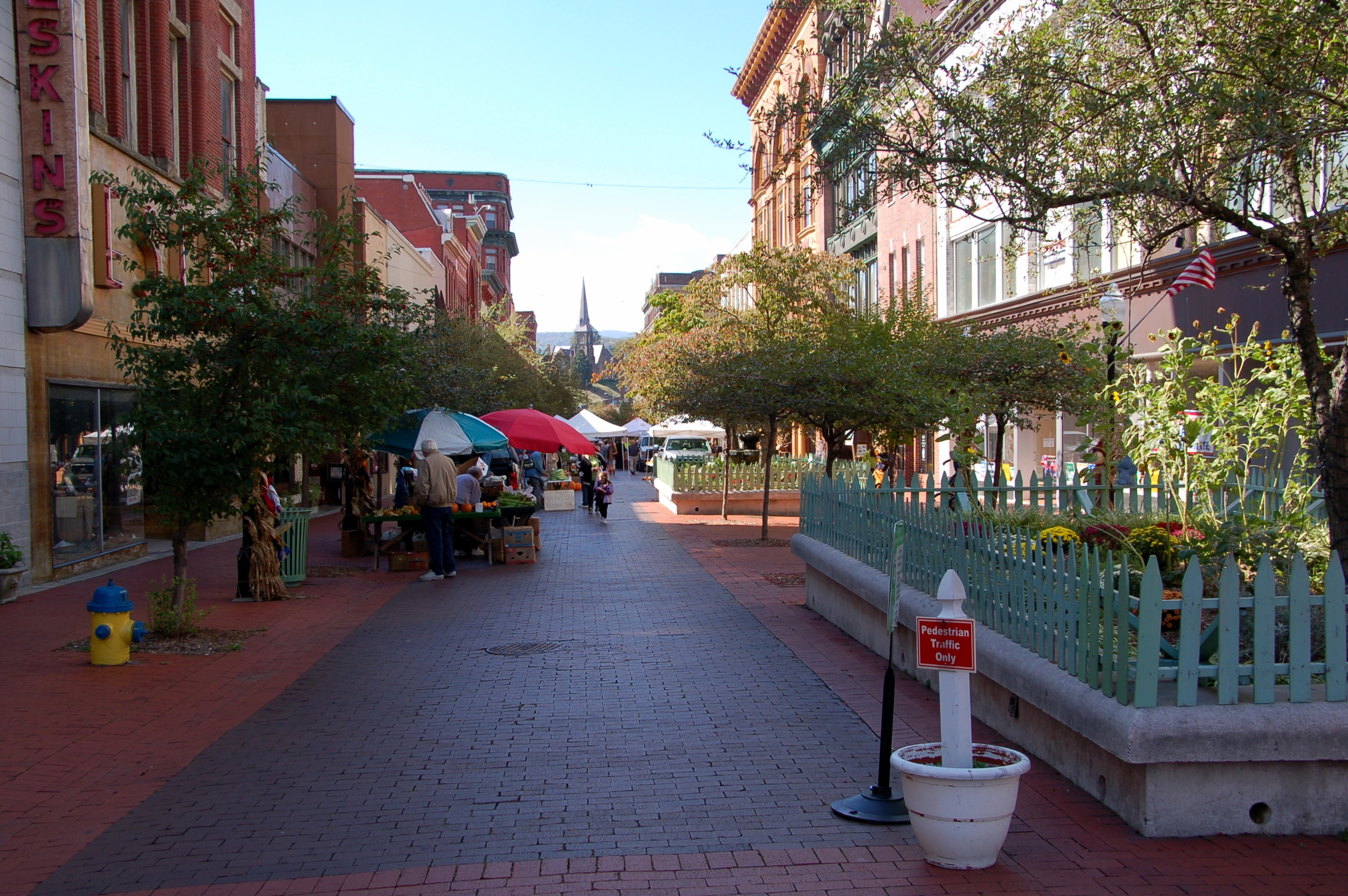
This is the Borough of Berlin, and it will probably be alright in the end—its daily bread and cheese are derived principally from the potato chip factory and the drilling equipment company that reside there—but I still can’t help fearing for the town now that its amenities have become forcibly hidden from the through traffic that they had long served and relied on. For the time being, though, it’s largely business as usual on this agreeably warm and clear late summer evening.

Most of the activity is concentrated around the intersection of Main Street, on which I have entered, and former U.S. 219, which carries the name Broadway Street through town. The town’s only stoplight presides over this crossroads, although it is not even really a stoplight but a set of four-way flashers that are programmed to give the motorists on Broadway a perpetual right-of-way.

On one corner, the door to the bar on the first floor of the New National Hotel has been propped open, allowing one to see that this watering hole is well attended when the barroom’s glass brick window, bathed in a soft red glow from a neon beer brand logo, would not otherwise permit such inquiries. Across Main Street from the New National Hotel, a motley crew of teenagers huddles outside the diner, where the final dinner customers of the night have just been seated. These youth are bored, but not menacing, as they clandestinely pass a lighter to spark illicitly purchased Marlboros.

The diner is affixed to a laundromat, which in turn is adjacent to a gas station/convenience store complex. The store is as comprehensively stocked as any generic Interstate Highway Travel Mart (at maybe a third of the square footage), complete with sandwich counter and DVD nook. I worry that it, especially, will face an appreciable decrease in commerce due to the abandonment of Broadway Street as part of a major interregional thoroughfare.

Opposite the diner/gas station/laundromat, occupying an otherwise mostly-unused parking lot, the Ice Cream Station has set up shop in its customary spot. A gem of a roadside confectionary housed in an unassuming trailer shack, at the moment it is doing brisk sales in dispensing cold treats from an impressively expansive menu to a long line of folks. Its popularity is, in my view, the most pleasing aspect of this town that does not seem immediately concerned with its attempted hamstringing.

berlin-icecream2.JPG

It is often while I’m queued up for an obligatory frozen dessert that the weight of how close I am to home reawakens to sit squarely on my shoulders. Weariness and anxiety congeal into a cloud over my head. It’s a feeling I’ve grown accustomed to experiencing, if only slightly better at coping with—though a butterscotch milkshake helps to assuage some of these gloomy thoughts.

As I head back to my car, I notice what I surmise to be four generations of a single family, clustered around a picnic table. Two of the men, one middle aged and one elder, are curiously decked out in the crisp, navy blue threads of the Army of the Potomac. They must be members of the Berlin Fife and Drum Corps, the oldest continuously-playing such unit in the country. Their melodies could be heard on Civil War battlefields, on the campaign trail with William McKinley, and at the dedication of the nearby Flight 93 Memorial. On this evening they’ve likely returned from an event in a neighboring town, hopefully some sort of festive procession, but perhaps a more somber affair, such as escorting the casket to a funeral.

I wonder if this particular family can trace its lineage in these parts back to the inception of the troupe near the end of the American Revolution, when veterans of the conflict who had made it back to their Brothersvalley homesteads came together to keep the music of their victory alive. Might one of their forefathers have erected a liberty pole in protest against Hamilton’s tax on distilled spirits?

As the family laughs over their twistees and sundaes, I chastise myself for carrying any negativity. Governor Mifflin has gone home to Philadelphia. Tonight, in Berlin, Pennsylvania, everything is as it should be.

September 29, 2016 /W. P. Hill
Comment

The Drive Home, Part II: The Scratch

September 22, 2016 by W. P. Hill

I-68 through Cumberland could be considered the Interstate Highway System's equivalent to an old wooden roller coaster. Originally built during the mid-1960s as an elevated solution for alleviating the city's local street grid from long-distance through traffic, it has hardly been upgraded since, even as a modern freeway filled in around it, connecting Hancock to Morgantown and points west.

Now it's so woefully below standard that it boasts one of the lowest posted speed limits on any controlled-access roadway in the country, dropping to 40 miles per hour as you slalom through town. Narrow lanes, a paucity of shoulder space, and virtually non-existent merge areas, not to mention the omnipresent neon orange cones, ungainly vehicles, and vest-clad crews unleashed by seemingly interminable construction . . . it all leaves an unsuspecting motorist suddenly nervous about how safe it really is, like those rickety amusement park thrill rides.

You might be so focused on navigating this anachronism of an expressway that you'll miss the view as I-68 swoops into the valley where Cumberland lies. The humble redbrick skyline is punctuated by a half-dozen church steeples and capped by the strikingly handsome Romanesque tower of the Allegany County Courthouse. In front of the green backdrop of Haystack Mountain, it looks almost like the two-dimensional set for a play, perhaps one about Cumberland's bustling and prosperous past.

Time was, a city could grow and thrive on the back of geography alone. All you needed was to be situated at the foot of an extensive mountain plateau, adjacent to a major river, surrounded by lush forests, and near a big vein of coal. Someone would see fit to build a canal connecting you to the wider world, followed by a plethora of railroads. Then would come the cornucopia of factories and mills.

Cumberland's rise is a familiar story, but then so is that of its decline. The halcyon years were not to last forever. America grew up and did its best to abandon its industrial childhood, preferring instead to hire other adolescent economies to do that dirty work on the cheap. Pittsburgh Plate & Glass shuttered its Cumberland plant in the early 1980s and a consolidating Goodyear yanked its Cumberland subsidiary back to Akron in 1987. After peaking at a modest but vibrant 40,000 residents during the war effort of the 1940s, the city today sits half empty, and those who remain have faced an uphill battle against lagging economic indicators and health-related factors like substance addiction.

On this particular late afternoon, the slanted light does an admirable job of trying to conceal the residual scars from such a dramatic turn of fortune. But in traversing the quiet streets of this once-lively burg at ground level, the clues are there to be seen.

There’s the corner bar, windowless but door ajar, the blue flicker emanating from televisions providing the strongest source of illumination inside the saloon. It’s enough to catch a fleeting glimpse of the old men, clutching their Buds and Millers and staring, blank-eyed, into the familiar security of the glowing boxes as their country rides off into the sunset without them.

Outside, there’s the couple, she overweight and wearing an early-aughts pop-punk band t-shirt and sweatpants, he string bean thin and clad in faded jeans and a stained beater. She pushes a stroller, while the orange tracer of a smoldering cigarette dangles from his lips. They can’t be much beyond their early twenties, but their faces are lined and worn, eyes sunken, belying their youth.

It’s a scene that’s replicated throughout the greater Appalachian region. These mountains were once the western frontier of a rising democratic, capitalist nation where anything was possible, defeating this natural barrier to expansion first and foremost among those possibilities. In fact, that quest lit one of the many fuses, if only a small one, beneath the powder keg of growing discontent within the then-Colonies. Many settlers felt aggrieved over what they viewed as an unnecessarily constipated process, enacted by their British overlords, for the exploration and occupation of western territories.

After they were conquered, the mountains gave up what they had beneath them, fueling a nation's ascendency to industrial juggernaut and thence to global power. Maybe it was a deal with the devil all along, but several generations on and for most of us, these locales are yet again blank spots on the map— "here be decay." Only this time, it's by design.

These hills were once the country’s metaphorical backbone, symbolic of Made In The U.S.A. ingenuity and bravado. But now we’d rather pretend we didn’t rape this land and all but eradicate its indigenous peoples just to give ourselves a leg up, only to bring the house of cards crashing down when it suited us, leaving millions scrambling to free themselves from the collapsed wreckage. No, it’s out of sight, out of mind, except as fodder for occasional empty, patronizing pity or cruel humor, ignorant jokes about inbreeding and poor dental conditions. Or, arguably even worse, to be used as a prop every couple of years by aspirational Leaders of the Free World, then promptly cast aside as each election cycle dissipates into hindsight.

But the truth persists that it’s a constantly evolving, unforgiving artificial world that our wealth-worshipping society has invented, and some places just aren’t going to survive. Bigger Rust Belt cities have had the wherewithal to facilitate a renaissance, generally by pivoting towards finance, medicine, education, and technology, but it's the smaller cities and towns that continue to fall through the cracks en masse. The young have no reason to stay but little means to leave. Meanwhile, the elder cohorts whittle away the days that are left to them, scraping by on the paltry remnants of severely dented promises—if not outright broken ones.

I want to trust that there’s hope, that the concept of the Great American Town isn’t in its Late Cretaceous period, the Doomsday Clock ticking towards the inevitable meteor, but the question of what happens next can’t simply be hand-waved. Perhaps, eventually, nature just runs its course, reclaiming the lands that once belonged solely to it.

Some places have tried to resuscitate themselves, to varying degrees of success, by reorienting outwardly and marketing themselves as a destination where people might be compelled to come dispose of their disposable income. It's not a foolproof panacea by any stretch. Such strategies are loaded with their own set of drawbacks and perils: The jobs created tend to be primarily of the lower-paying service variety; it doesn't take much to disrupt a tourism-dependent economy (a severe weather event at an inopportune time, for instance); too much popularity can lead to runaway gentrification. But surely it's better than just sinking into oblivion?

Cumberland, for its part, has turned to the vestiges of its past importance in its own gambit for survival. The Chesapeake and Ohio Canal was an engineering marvel in its day, enabling boat traffic to smoothly bypass the Potomac River’s often-unruly flow between Cumberland and Washington, D.C. In spite of rail's depressing effect on water commerce, the canal managed to maintain its utility well into the railroad era.

Today, the entire length of its towpath has been transformed into a National Park Service-administered bike trail, which hooks up with another major trail in Cumberland: the mostly paved Great Allegheny Passage, which occupies the former right-of-way of the Western Maryland Railroad and continues on all the way to Pittsburgh. At 330-plus miles, it's the longest unbroken bike path in the country, whose "golden spike" connection has made Cumberland into a bicycling mecca of sorts.

The iron horse is in on the act, too. The Western Maryland terminal has been restored and operates popular excursion trains to nearby Frostburg and back.

How much effect has been yielded by these endeavors? Per the immediate eye test, it doesn’t seem to be a whole lot. For every house whose upkeep visibly appears to be the product of attentive care, there are three or four on the same block that are scuzzy and ramshackle, unpleasantly playing right into the negative stereotypes of Appalachia.

Commercially, a similar story is spun at first glance. During the mid-1970s, downtown Cumberland’s main shopping street, Baltimore Street, was converted into a pedestrian-only promenade, last-ditch chemotherapy aimed at a cancer that had already metastasized. It was a maneuver that was tried all over the country in economically waning small industrial cities and towns, and pedestrian malls were unfairly scapegoated when those places suffered anyway. That stigma in the urban planner's manual has taken decades to erode, and even today there are plans in place to re-convert Baltimore Street into a thoroughfare for motor traffic.

Regardless of its final form, though, a pulse is fluttering once again through its brick paving. There are a handful of real restaurants interspersed among the junky "antique" shops and vacant storefronts, plus a coffee cafe that would not be out of place in Portland, and even a bona fide bakery. The centerpiece is a renovated and refurbished 1930s theater that now hosts events of all types, from stage performances and classic film screenings to DJ sets and bachelor auctions. Former Tony Award-nominated Broadway actor and Cumberland native Mark Baker lent New York gravitas to the project until his death in 2018. Though no one would quite mistake Cumberland for the West Village, slow motion has to be better than no motion.

At the foot of Baltimore Street, a bridge crosses Wills Creek over to the hill upon which stood Fort Cumberland, in its time a tangible manifestation of the very limits of white man's control over this New World.

The fort was the site of a key moment in the early military career of George Washington. The Virginia militiaman was largely responsible for leading the killed-in-action General Braddock's troops in retreat to Fort Cumberland following their humiliating defeat at the Battle of the Monongahela outside present-day Pittsburgh in 1755, during the French and Indian War. Washington's "gallant behavior" in a bleak situation earned him a permanent command of the Virginia Regiment. The rest, as they say, is history.

The county courthouse and an Episcopal church now occupy the footprint of the fort, but the one-room cabin that served as Washington's headquarters has been preserved and moved across the street to a creekside parklet. Outside the cabin stands another emblem of history: a stone obelisk, demarcating the beginning of the Old National Road.

Logically, when the National Road was laid out, much of its route from Cumberland into southwestern Pennsylvania followed the path blazed by Braddock’s doomed expedition, itself pieced together with ample assistance from friendly Indian groups whose hunting trails had been unlocking these mountains since time immemorial. Centuries later, we’re conveyed in multi-ton metal chariots with the comfort of climate control and smartphones to hold our hands as we hurtle along at speeds once the stuff of pure fantasy, but damned if we’re not still just following in Chief Nemacolin’s footsteps.

As suffering places scratch and claw to find their way in this exponentially unfolding epoch of technology that is ruthlessly doing its utmost to leave them behind, I can't help but sense an optimistic allegory in the presence of Mile Marker Zero. There is still possibility. We have to believe it can and will arise for those who are able to forge a new direction forward out of what came before. The sad truth is it won't happen for everyone, everywhere, but the more that goes right for hurting communities across these states, the better off we'll all be for it.

September 22, 2016 /W. P. Hill
1 Comment

The Drive Home, Part I: The Itch

September 17, 2016 by W. P. Hill

Like so many seedlings of idle thought that mushroom into a web of dangerous ideas, it’s spawned from cliché: in this case, a few trite stanzas about how the concept of The West is as much a part of the DNA of the United States of America as apple pie and baseball.

The Union's predecessors arrived here from Europe, having voyaged across the western sea that was once believed to be the literal end of the earth. A massive continent, unknown and mysterious, sprawled out before them to the west, ripe for devastating incursion. Long after the geographic extent of this domain was shorn of its mystery by the quest for the Northwest Passage, Lewis and Clark's intrepid expedition, and the rapacious forces of Manifest Destiny, the allure of The West remained a siren's call for many.

At first it was the enticement of material wealth and prosperity in the form of animal pelts or mineral extraction. In the isolation concocted by its difficult terrain and unforgiving environment was the answer for those seeking freedom to practice unorthodox religions, or perhaps those craving the illusion of evading the snare of the government. It was also, it would be remiss to forget, an involuntary destination for entire cultures, violently removed from their ancestral homes and marched west, where they were left to forge a new existence in the face of white supremacy's continuous efforts to thwart them.

The laying of the transcontinental rail lines, followed by the rise of the automobile, made The West accessible in ways that were once inconceivable. Anyone who wanted a new life could simply uproot themselves and strike out for The West. It was clung to as a promise of salvation from the smoky, claustrophobic hell of the industrial metropoles and from the inhospitable, barren hell of the Dust Bowl. Even today, it beckons as the wide-open land of the big sky, a haven for rugged individuality . . . or as the land of left-coast social tolerance and unapologetic entrepreneurialism and innovation.

I myself am not immune to the seductive qualities of The West. They permeate through the spirit of the specific road that facilitates my egress from the Beltway region. This is Interstate 70, a 2,151-mile superhighway that births in Baltimore and ends up in Utah, serving as a crucial connection between The West and the entire Midwest and Northeast. If you hop on I-70 at its starting point and get going westbound, almost immediately you’ll come across a green guide sign listing a few prominent cities along the highway’s track, plus their distance away in miles. At the bottom is an entry for COVE FORT, the unincorporated spot that acts as I-70’s western terminus, where it runs into I-15 to continue on in the direction of Vegas and L.A. The sign informs those who blur past it that Cove Fort is separated from them by 2,200 westerly miles. Seeing that number never fails to remind me that this country is still somehow an unwritten tale, no matter how times you crisscross it or how many counties you chalk off.

For much of its path, I-70 is intertwined with U.S. Route 40, which itself was one of the original coast-to-coast routes laid out in the groundbreaking 1926 U.S. Highway System Plan. Going back further, this particular portion of the I-70/U.S. 40 corridor closely traces the echo of a series of late-18th-century turnpikes that stretched from the teeming ports of the Upper Chesapeake to Cumberland, Maryland. There, travelers could embark upon what was known as the National Road.

The National Road was one of the country’s first efforts, propelled by federal funding and oversight, to create a cohesive, long-distance transportation trail. Its objective was to ensure a standard of relatively easy mobility between the industrial and economic centers of the Mid-Atlantic and the croplands of the Midwest, traversing the tricky Appalachian Mountains in the process. Running from Cumberland to Vandalia, Illinois, it was the first road of such length to be completely surfaced using the newfangled Macadam technique, which would in short order come to be regarded as the state-of-the-art standard for road construction. Thus it can be said that these easternmost miles of I-70 essentially represent the very cradle of our attempts as a nation to provide simple, comfortable access to The West.

The battle against the Appalachian topography is still being waged in the name of increasing efficiency. One comparatively recent example is the Sideling Hill road cut, blasted away in the 1980s to make room for the Interstate 68 footprint. I-68 diverges from I-70's Pennsylvania Turnpike-bound course at Hancock, Maryland, but most westbound travelers pay it scant thought, unthinkingly guided as they are by automated navigation devices and apps.

I, on the other hand, have learned to heed the signs advertising I-68 as an "Alternate Route West." Maryland's Highway Administration has erected the signs as a ploy to keep people south of the Mason-Dixon Line for as long as possible and in doing so, hopefully trickling a few additional dollar bills into the coffers of the businesses and communities of the state's westernmost counties. To me, though, the signs serve as another reminder—as if I need one—that the ultimate purpose of this road's existence is to get people from here, in the East, to way over there, in The West, through those amber waves of grain and across those purple mountain majesties.

In any case, I had long taken to incorporating I-68 into my often thrice-monthly 202-to-412 commute. As far as controlled-access hypno-roads go, 68 is a rather enjoyable drive, thanks in large part to lower traffic volumes, lovely ridge-and-valley scenery, and an absence of tolls. Exits are more plentiful and offer the ability to jump on and off the highway whenever I want, enabling me to explore local towns and attractions at will and patronize commercial ventures that weren’t hatched out of a prefabricated big box.

At least, this pretense of true liberty is the fragile bargain I’ve struck with myself in exchange for ignoring the temptation of The West and instead surrendering to the imperious pull of my predetermined destination: home. It is all so nearly undone by the fact that I frequently find myself rumbling along I-68 as the day is waning. The sun reclines into the western sky, casting its pastel hues over the humps and hollows of the Maryland Panhandle, and I am drawn into its canvas, beckoned to follow it over the horizon. I want to succumb, riding into the sunset until I can’t anymore . . . or maybe just until I come across a cheap motel for the night, where I can recharge before leaping into whatever sagas the next day will sow.

To be clear, for me, it is not merely some escapist fantasy, not born of any explicit yearning to seek out a geographic cure by picking up and living in The West. No, it is the same compulsion that impassioned George Mallory to vanquish the planet's most daunting natural wonder. It is to just go. Because it's there. And every time, I swear there's a good five-Mississippi count during which I actually consider doing it.

But then irresponsibility is bludgeoned and the impulse is wrested from me, leaving only an odd burning sensation in my gut (not wholly unlike the feeling you get after narrowly averting an accident of some kind). As I brood over yet another capitulation, autopilot kicks in and forces me to take the appropriate exit into Cumberland. I’m not going West, not today. I’m still going home. Maybe one day I'll get used to that fact.

September 17, 2016 /W. P. Hill
1 Comment

The Drive Home, Prologue: The Bite

September 15, 2016 by W. P. Hill

It's not a stretch to suggest that the vast majority of Americans regard roads purely as a utility, to the extent that they think about them at all. There are nearly 2.7 million miles of paved road in the United States according to the Department of Transportation, after all. It's no wonder that most people can't be bothered to spare active thought for the negligible fraction of them that they drive on over the course of a given day or week or month or year. It also doesn't help that a high percentage of these trips are likely part of a recurring routine or commute. Familiarity breeds contempt; repetition begets boredom.

This might have posed a problem for me when I found myself making upwards of several round trips a month between my hometown of Pittsburgh and Washington, D.C. That is, at least, until I had the epiphany that a share of the blame must be shouldered by modern humanity's—and especially America's—everlasting obsession with efficiency for efficiency's sake.

The Germans may lay claim to the base invention of long-haul travel by automobile, but only in the United States, unique amongst the industrial giants of the early 20th century for her undeniable immensity, physiographic diversity, and mostly manageable climate could the idea become so inextricably linked to the ethos of a nation.

By returning agency to the hands of the individual traveler, the road trip put the adventure back into the process of Getting There in ways that trains, with their rigid timetables and inflexible tracks, could not. At the same time, there developed unprecedented comfort and safety in road travel. A hot meal and a bed to sleep in were never far away, and itinerant crime like banditry was almost wholly a plague of yesteryear, a relic of the stagecoach era.

But then car ownership became more and more ubiquitous. Two lanes turned into four, which multiplied into six, eight, ten, sealed off from the surrounding world and accessible only via sporadic, fixed airlocks. I won’t argue against the bare necessity of a transcontinental autobahn network as prescribed by Eisenhower, but one of its regrettable byproducts has been the homogenization and sterilization of long-distance road travel. Where it was once a diversion, it’s now seen as a necessary evil in the eyes of most who undertake it.

We've been conditioned to believe that the entire raison d'être of roads is to go from point A to point B in the least amount of time, a maxim that tends to unilaterally inform our choice of routes. We must take the road that will allow us to arrive at our destination the soonest, simply because it’s available to us. On such roads, we then expect—no, we deserve the inviolable right to constantly zoom along at whatever speed we want. In that frame of mind, it becomes impossible to actually enjoy the journey, since every minor slowdown swells into a serious irritant.

I figured out that it didn't have to be this way when I finally broke the spell cast by the Pennsylvania Turnpike's poisonous promise of the earliest possible disembarkation. It dawned on me that I was under no obligation to meekly accept its mind-numbing grind, its ever-increasing tolls slipping invisibly and insidiously away from my EZ-Pass transponder, nor its legions of “just-get-there” travelers, many of whom haven't the faintest notion of proper lane usage. Not to mention having to endure the very concept of Breezewood, a festering sore of gas stations, fast food outposts, and cut-rate lodging crammed into a quarter-mile stretch of seemingly always-red traffic lights that, thanks to provincial political machinations, there's no easy or obvious way to avoid.

And so I set about devising an alternate route home, honing it through hundreds of hours and thousands of miles of trial and error until it congealed into clear preference. Where the Turnpike feels like a chore, a monotonous countdown of mile markers until I reach my destination and no further, this new route has had the totally opposite effect of sparking a sense of freedom and excitement. Since I'm already rebelling against the motivation of utmost haste, the door is left wide open, in theory, for just a bit further. One more hour of daylight. One more turn I've never made before.

The sheer possibilities are exhilarating, even if the neurons responsible for rational decision-making always just about prevent me from whimsically entertaining them. But the important thing is that instead of confining me, I've permitted the road to liberate my mind and my soul. As someone who is most restless when he's stationary and most at peace when he's in between places, that's all I could ever ask for.

September 15, 2016 /W. P. Hill
Comment
  • Newer
  • Older

Powered by Squarespace